Drones are becoming essential equipment for photographers and vloggers, and they have started creating more creative content with the help of drones. The content that is created by drones requires proper planning and plotting. As drones come with their application, the issue of complete accessibility and usage is still there. Many users can still not capture the whole scenario as they have thought or planned.
Why Is My Drone Not Flying Straight? Troubleshooting Tips can help ensure that your drone operates smoothly while capturing aerial shots.
Mobile apps for taking photographs are already available, but you are required some additional applications that enable you to take maximum leverage from every single flight. Such applications guide you to the proper place to fly a drone along with weather conditions. You can create a complete plan with the help of these apps and capture the subject creatively. These apps give you full control over your drone, and you can explore the area without violating any rules and restrictions.
To improve your aerial imagery and photography, check out Effective Apps to Improve the Drone Photography.
This article covers the best app for drone photography that would enhance your creative experience:
⤷ AirMap
⤷ Google Maps
⤷ Litchi
⤷ Kittyhawk
⤷ DJI GO
⤷ Sky Viper Simulator
⤷ Autopilot
⤷ UAV Forecast
⤷ Hover
AirMap:
AirMap is an advanced-level app that offers you important features like an awareness system and digital notice.

You can get information about the air traffic and receive immediate notification in case of any other airplane near your drone.
Google Maps:
You can get different suggestions to find the best places for your flight, and it gives you proper guidance to make your flight successful. Google Maps is an easy-to-use application that guides you to plan your flight in advance.
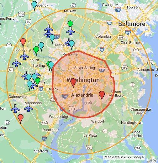
You can even measure the distances with the help of this app.
Litchi:
Litchi is another quadcopter application that comes with a tracking feature that enhances your video graphing experience. You can access its different video modes such as focus, VR mode, Waypoints, ground station, orbit me, Panorama, and follow me.
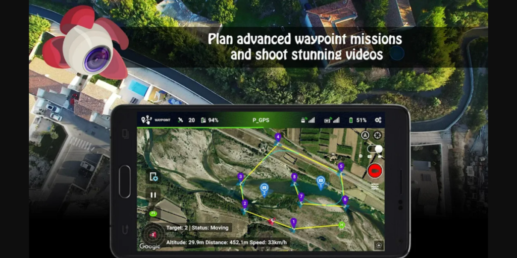
It guides you to plan your flights in advance on your desktop, and the drone flies automatically based on the decided plan.
Kittyhawk:
It is the best drone app for beginners, and it gives you information like weather conditions, air traffic, location suggestions, and more. It is certified with RPIC and gives you information like batteries, checklists, and other equipment.

DJI GO:
DJI GO is one of the popular apps that enables you to get complete control over the camera of your drone. It is compatible with both android and iOS systems and allows you to share the media directly through this app.

DJI GO enables you to edit the photos and videos and comes with some interesting features like logging, data tracking for flight, live HD view, various smart flight modes, and many others.
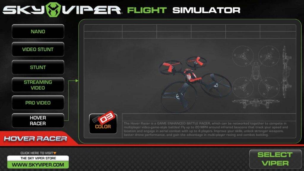
Sky Viper Simulator:
Sky Viper Simulator is the best simulation application that works on both iOS and Android devices. You can easily practice this app without using any other quadrocopter app. It allows you to practice photograph and video creation by giving you complete control. The best feature of this app is that you can practice the simplest drone and the complex ones.
Autopilot:
Autopilot is a supporting app that enables you to get complete control over your drones so that you can improve your photographic results. It comes with a cloud-based database where you can store all your information directly through your devices.
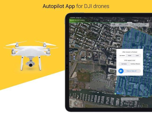
You can solve any issue as it helps you to simplify your troubleshooting process. It comes with a video tutorial where you can learn about updated information.
UAV Forecast:
UAV Forecast is a free application that enables you to select the best time to fly your drone. You are required to provide information about your time, desired location, and quadcopter. After analyzing your information and getting reliable data about safe flights, it displays the information.
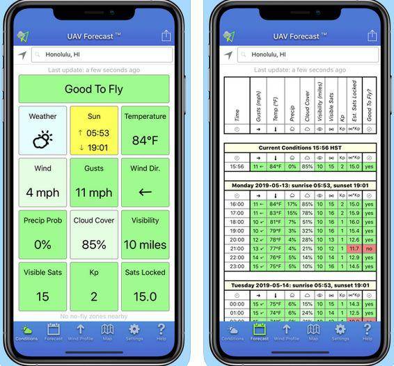
It gives you information about air humidity, temperature, speed, wind direction, visibility, and cloud situation. This app is compatible with iOS and Android systems and provides you with information accessed by the public.
Hover:
Hover gets its information from AirMap and gives you a complete guideline to fly the drone in the best location. It is a most useful app for a long shooting session and gives you the importance of the weather condition. You receive instant notification in case of any air traffic.
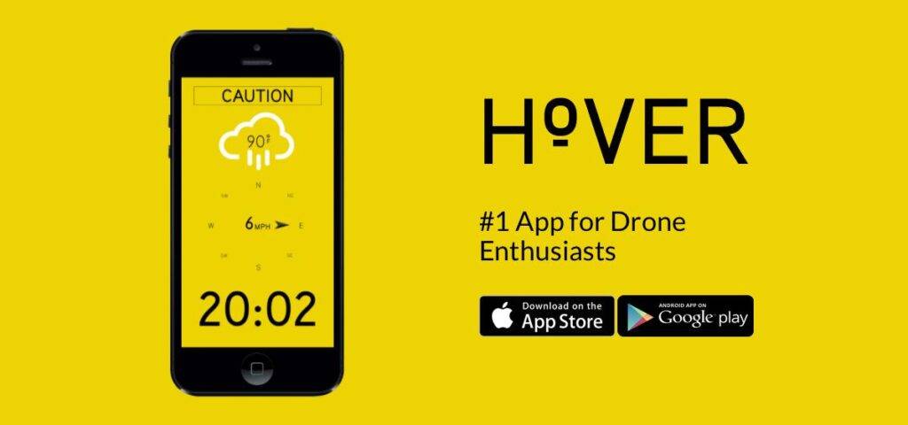
Its flight logging feature enables you to save the media on your devices and seamlessly share it with others. The best feature of this app is that it improves your photography skills and gives you a bird’s-eye view.
Conclusion:
Above mentioned apps help you to plan the drone flight effectively, and you can take drone videos and photographs professionally. You can explore the area in more detail and find exciting places to capture. These apps are easy-to-use and enable you to take the maximum leverage from every flight.
To see how drones contribute to other industries, explore How Drones Can Increase Scalability for Projects and Agriculture Drone Technology.